What is the chart and why is it a key block?
The navigation chart is the map of the sea: on it you fix your position, plot the course you are going to follow and measure how far is left to your destination. In the PER exam, the chart (UT11) is an eliminating block (you need a minimum number of correct answers) and it is one of the most feared, because it is solved by drawing and measuring, not just by remembering. The good news: it is four or five operations that, once you understand them, are always done the same way.
What a nautical chart is like
Charts use the Mercator projection: meridians and parallels appear as straight lines, which lets you plot and measure courses, distances and bearings with a rule and protractor. On the side margins is the latitude scale; at the top and bottom, the longitude scale. The position of a point is given by its coordinates: latitude (N/S) and longitude (E/W).
The golden rule of distances
A nautical mile equals one minute of latitude (1′ = 1 mile = 1,852 m). So, to measure a distance:
- Open the dividers between the two points.
- Take that spread to the latitude scale (the side margins), at the level of the mean latitude of the two points.
- Count the minutes: each minute is a mile.
Never measure on the longitude scale (top/bottom): a minute of longitude does not measure a mile except at the equator, and would give you a wrong distance. This is the most typical mistake in the block.
The compass rose and the variation
On the chart there is a compass rose that marks true north and, inside it, the value and date of the magnetic declination (variation) with its annual change. You use it to go from true course (Rv, the one you measure on the chart) to compass course (Ra, the one you steer), and vice versa.
The instruments
- Dividers: to measure distances on the latitude scale.
- Parallel rule (or rules/set squares) and protractor: to plot and measure courses and bearings relative to the nearest meridian.
Fixing your position, measuring course and distance

- Coordinates of a point: take the point to the latitude and longitude scales to read its coordinates; or, given the coordinates, place it at the intersection of its parallel and its meridian.
- Course and distance between two points: join A and B with a line; measure its direction with the parallel rule and the protractor (true course), and its length on the latitude scale (distance).
Fixing your position by two bearings (the fix)
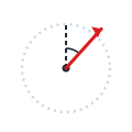
Your position is the intersection of two position lines. The most common: two true bearings to two lighthouses. You take the bearing with the compass, convert it to true (with the total correction) and plot the line from each lighthouse; where they cross, that is where you are. Try to have the two bearings cross at a wide angle so the fix is reliable.
Dead reckoning
Dead reckoning works out where you will be from your position, your true course and your speed: you cover distance = speed × time on that course. Graphically, you plot the course from your initial position and, along it, the distance run (measured on the latitude scale). The wind (leeway) and the current deflect the track, and are corrected separately.
A worked example on a practice chart
So you can see it all together, here is our practice chart «Costa de Poniente» (variation 2° W). Tap to enlarge it.
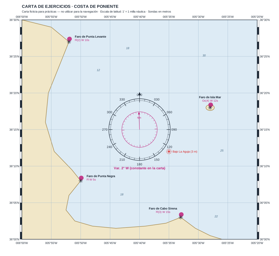
- Course and distance from the Punta Levante lighthouse (36°27′N 005°52′W) to the Cabo Sirena lighthouse (36°03′N 005°33′W): plot the line, measure with the rose → Rv 147° (true course), and measure the length on the latitude scale → about 28.5 miles. (If you measured it on the longitude scale you would get about 30.5: that is exactly the mistake the golden rule avoids.)
- Fix by two bearings: if you take Dv 321° (true bearing) to the Punta Levante lighthouse and Dv 098° to the Isla Mar lighthouse, the two position lines cross at 36°20′N 005°45′W. That is your position.
How to pass the chart block
- Always measure distances on the latitude scale, at the mean latitude. It is the mistake that costs the most.
- Plot carefully: a crooked line carries the error through to the answer.
- Review the step true course ↔ compass course with the variation of the rose (you will see it in detail in the navigation theory guide).
It is an eliminating block (min. 2/4): with four well-practised operations you have it. In our mock exam, the chart questions share an enlargeable chart and the result warns you if you do not reach the minimum.
Practise this topic